Airsheds
The Colville Reservation is located within two key airsheds: the Okanogan River Airshed and the Upper Columbia River Airshed. These regional air basins help define how air moves across the landscape, how pollution behaves, and how we coordinate with partners to protect the health of our environment and our people.
Our Air Quality Program participates in both airshed groups to strengthen monitoring, improve smoke response, and support clean air initiatives throughout the reservation.
The Okanogan River Airshed Partnership (ORAP) brings together Tribal, county, state, and federal agencies to reduce air pollution and smoke impacts in the Okanogan River Valley. Much of the western portion of the Colville Reservation sits within this airshed, especially communities along the valley.
This partnership focuses on:
Strategies to reduce smoke
Expanding community air monitoring using PurpleAir sensors
Reducing emissions from wood stoves and open burning
Sharing real-time air quality data with the public
Educating residents on clean air practices
ORAP plays a key role in supporting the Tribes’ goals around wildfire smoke preparedness and healthier home heating options for residents.
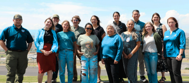
Spring 2025 - Okangoan River Airshed Partnership Biannual Meeting
Upper Columbia River Airshed
The Upper Columbia River Airshed covers much of the eastern and northern reservation, stretching from the U.S.–Canada border southward toward the Spokane River. This airshed includes forests, canyons, and communities that are especially vulnerable to seasonal wildfire smoke, windblown dust, and stagnant winter air.
The Colville Tribes are committed to protecting air quality across the Upper Columbia River airshed. We’re working with local partners to expand community awareness—especially during wildfire season, when smoke can seriously impact our health.
We’re currently looking for volunteers to host PurpleAir monitors at locations near the Columbia River, anywhere between the U.S.–Canada border and the Spokane River confluence.
These small, low-maintenance sensors send real-time air quality data to public websites. By increasing the number of monitors in this area, we can help ensure that our communities have better access to up-to-date air quality information and can take action when pollution levels rise.
Why This Matters
There are currently very few air quality monitors in the Upper Columbia River airshed. Adding more sensors helps fill critical gaps—especially in rural and Tribal communities—so we can:
Track wildfire smoke and dust in real time
Make informed health decisions
Improve emergency preparedness
Strengthen our collective air quality data
How PurpleAir Sensors Work
PurpleAir monitors use an internal laser to measure tiny particles in the air, like smoke and dust (known as PM2.5). These sensors don’t analyze the content of the particles, but they do provide accurate, real-time data that anyone can view online.
Interested in Hosting a Monitor?
If you live near the Upper Columbia River and want to host a monitor, please fill out our short interest form:


